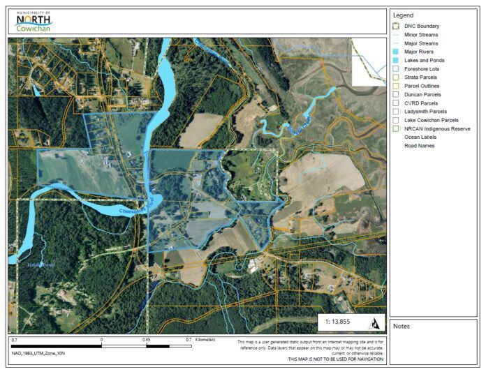
The Municipality of North Cowichan has issued an evacuation alert for properties in a low-lying area between Crofton and Chemainus.
High water levels are increasing the potential for flooding along Chemainus Road and Crofton Road.
This morning, Chemainus Road north of Mount sicker road and Crofton Road north of Chaplin road were closed.
The areas affected by the evacuation alert are Chemainus Road east of Halalt First Nation and south of Ashcroft Road, Crofton Road north of Tsussie Road, Swallowfield Road and Amos Road south of Ashcroft Road.
There is no order to evacuate at this time, the alert is to ensure residents of the area prepare to leave quickly if an one is issued.
North Cowichan asks residents of the area to:
– Locate all family members and designate a meeting area outside the evacuation area, should an Evacuation Order be called while separated
– Pre-pack essential items such as government-issued ID, medications, eyeglasses, valuable papers (e.g., insurance, credit, and mortgage information), immediate care needs for dependents and, if time and space permits, keepsakes for quick departure.
– Prepare to move disabled persons, children and/or neighbours where additional assistance or time may be needed.
– Prepare to take pets with you and move livestock to a safe area if possible.
– Arrange transportation for all your household members- Fill the gas tanks of personal vehicles
– Plan alternate accommodations for all members of the residence, if possible.
– Wait for an Evacuation Order to be issued before evacuating.
– Monitor local radio stations and Cowichan Alert for additional information.
The municipality says melting snow has increased river flows and a storm surge is expected at high tide.
Rain and warmer temperatures are causing snow to melt rapidly, increasing the threat of localized flooding.
Earlier in the day North Cowichan warned that because of the “upcoming December 27 king tide event,” residents in low-lying places should be prepared.
People are advised to clear snow from storm drains surrounding your home or business, and check eaves and downspouts to ensure the melting snow and water are draining appropriately.
Other potential danger spots outside of the flood protection area in North Cowichan include Mary and Philip Streets, Rosewood Avenue, and Seine Road.
The municipality warns there may be flooding in other places because of clogged culverts and catch basins, and ditches filled to capacity.
The Cowichan Valley Regional District has made sand and sandbags available for people who need them.
They can be found near Pinson corner store, Russell Farms, and Bings Creek Transfer Station on Drinkwater Road.
The sandbags are not filled, so residents needing them will have bring their own shovel.
The River Forecast Centre has issued a flood watch for Vancouver Island from Campbell River south to Victoria.


